All Posts By

Frank

Wairarapa Walking Festival

By Walking Festival

Festival walking the talk on Wairarapa’s treasures

Wairarapa Walking Festival, from 10-19 November 2023

Organisers of the Wairarapa Walking Festival will be putting the region’s best foot forward with many walks that will celebrate local culture, scenery and community.

“There are so many great options, from short walks, family and buggy or wheel friendly options, to bush walks, cultural and history, early morning, or star gazing,” says event convenor, Celia Wade-Brown.

The festival runs from 10 to 19 November, with the majority of walks free, although prior registration is required.

“We’re excited to showcase some of the Wairarapa’s best known walks, as well as some hidden gems that aren’t normally open to the public.”

Whareama Coastal Walk is offering an afternoon taster of their popular private farmland track, offering spectacular views of the Wairarapa coastline. Astronomer Becky Bateman will lead a guided walk under the stars, on the Greytown Rail Trail. Go Carterton has organised a meander through vineyards, ending with wine tastings, olive oil, and platters at Leafy Ridge Olives. Pre-schoolers can use their eyes, ears, noses, and mouths with a guided sensory walk at Fensham Reserve.

Wade-Brown says the festival will also highlight local ecosystems with walks showcasing native species such as long-tailed bats, orchids, New Zealand dotterel, and Raukawa geckos.

“Walkers will discover cultural sites surrounding Hurunui-o-Rangi Marae, historical buildings, Masterton’s 1945 US Marine Corps camps, and the gravesite of the world’s first registered nurse.”

Most of the town walks are wheelchair and pushchair friendly, and – keeping it green – Metlink and Tranzit are providing free buses to a number of events.

“Our festival values are, learn, explore, and connect. Ako, hōpara, hono. We want to offer people the opportunity to learn about our history and our physical world.”

Walk the Queen Charlotte Track

By Marlborough Walks, Walking Tours etc

Not all who wander are lost

It’s time to explore and find what a great country we have here in New Zealand.

By Juliet Gibbons

New Zealanders have always been great travellers.

The ‘OE’ has been a rite of passage for many, drawing Kiwis to explore far flung corners of the globe. But these days a new phenomenon, the ‘DE’ seems to have taken on greater appeal.

Otherwise known as the ‘domestic experience’, this emerging tradition is more than likely due in no small part to a global pandemic, conflict in Europe and a climate conversation which has some thinking twice about international travel.

It is also a renaissance to a simpler time and a great chance for people to reconnect with nature, says Juliet Gibbons, the co-owner of Wilderness Guides based in Picton.

“I think a lot of New Zealanders have fallen in love with their own country during what has been a difficult couple of years. That saying has become true – not all who wander are really lost,” she says.

“Kiwis have got out and about, when they could, explored their backyard, done something new and realised what a great country we live in.”

Juliet and her husband Steve have operated Wilderness Guides for 23 years this October and she says prior to Covid, life was going along very well.

“We had just celebrated the 20th anniversary of the business with our staff and life could not have been better.  A few months on and we were wondering where to from here.”

The couple had had tough years before. In their first year of business, there was a severe drought that affected many parts of Marlborough including the Marlborough Sounds.  Parts of the Queen Charlotte Track were forced to close due to fire risk and being their first year, it was a financial disaster and almost forced them out of business.

“Somehow we managed to survive back then and now, with support of family, staff and New Zealanders who have continued to travel and explore their backyard, we have come through,” she said.

“We have welcomed more New Zealanders than ever through our doors to experience the Queen Charlotte Track. It has been humbling to have this support and exciting to be showing fellow Kiwis what a fantastic place the Marlborough Sounds is.”

Juliet is confident Kiwis will continue to travel domestically despite the opening of New Zealand’s borders to the rest of the world and international travel resuming. “It is going to take a while for us all to feel relaxed about travel – and perhaps we won’t ever see that same scale of travel again. Perhaps that’s not a bad thing,” she says.

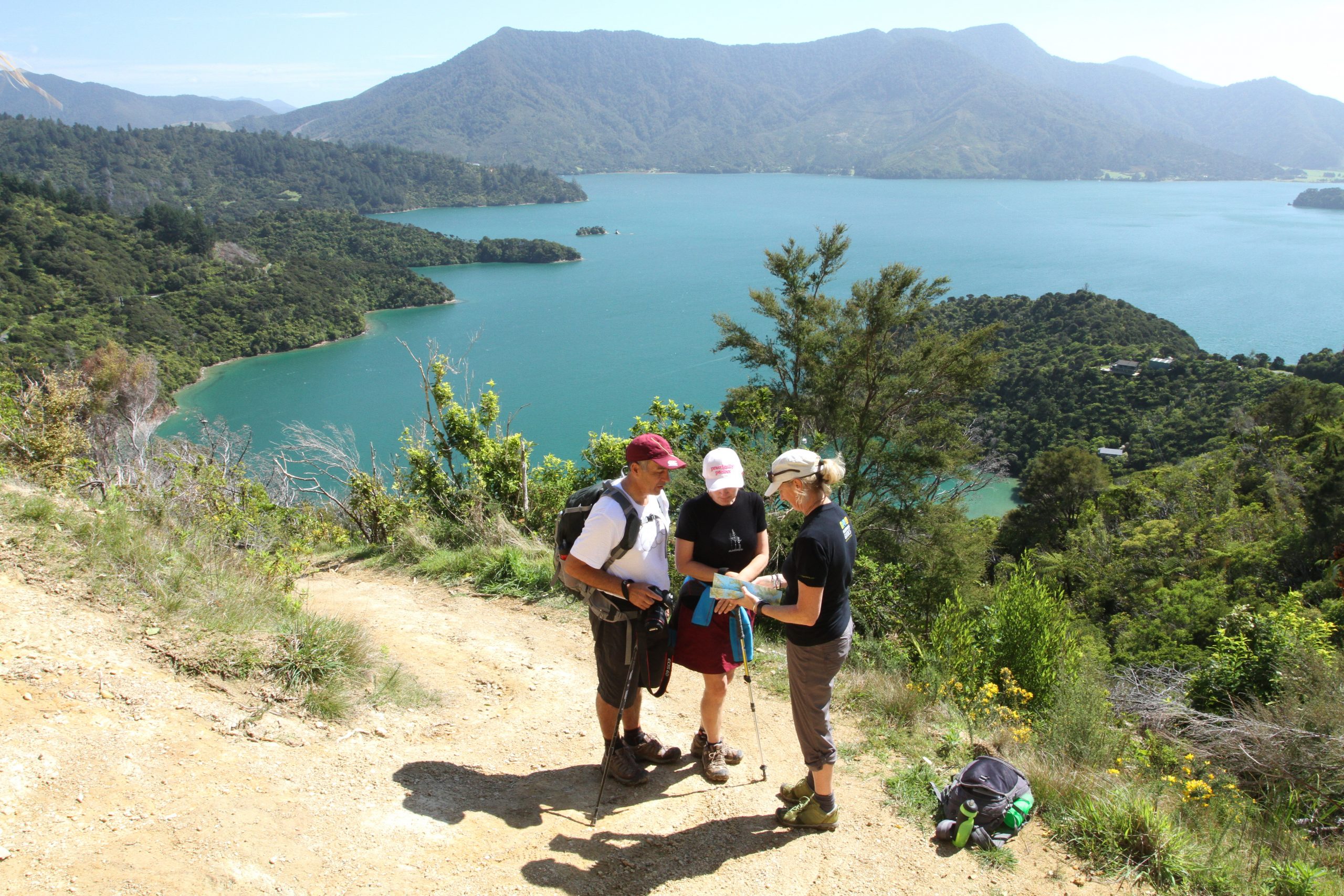
Ranging from one day to many days in length a trip on the spectacular Queen Charlotte Track with Wilderness Guides is about good times, relaxation, exploration, conservation, and great local food.

Moreover, Juliet says, the setting, in the geologically unique Sounds, a labyrinth of drowned river valleys and sheltered peninsulas, waterways and islands which stretch over 1500km, is unique in the world.

“Meretoto/Ship Cove, where the Queen Charlotte Track begins, is a site of both national and international significance where the first sustained contact between the New Zealand Māori and the European took place,” she says. It was here at this snug cove in the outer Queen Charlotte Sound he replenished water supplies, rested his men, and repaired his ships on five different visits between 1770 and 1777.

Despite the Queen Charlotte Track not being part of the Great Walk network, its popularity has remained strong with New Zealanders.

“We just do what we do here in the Marlborough Sounds.  Great walks really are in the hearts and minds of those who experience them and without a doubt, the Queen Charlotte Track is one of the best,” Juliet says.

The couple have spent more than two decades sharing their backyard with thousands of visitors to the region every year and sending them home with fond memories of the Marlborough Sounds.

“We have made life-long friends with so many customers, staff, and business colleagues along the way. Tourism is a rewarding and positive industry to work in.”

“Our kayak, bike and walk tours totally immerse people in the Marlborough Sounds environment, be it walking or biking along the Queen Charlotte Track or The Link Pathway or kayaking around the beautiful bays and coves of Queen Charlotte Sound. Our staff are our biggest asset – they love their job, and it shows as they share this place with our guests, be they locals or visitors to the region,” said Juliet.

“I guess the unique thing about Wilderness Guides Marlborough Sounds is us and the positive work environment we create for our team to ensure we give the best possible experience to all the holidaymakers that come through our doors.  We have always been completely dedicated to the concept of customer first.”

The couple’s children Ben (15) and Lizzie (12) are now helping in the business as well and Juliet says the couple have a keen sense of responsibility to leave a positive legacy in the Marlborough Sounds for future generations.

“We feel that our industry can be leaders in this, and it is something we are working on to find the right way to do so.  Overseas visitors see in a heartbeat what a special place the Marlborough Sounds is – we as locals have the responsibility to ensure it stays that way and is sensitively managed while constantly balancing the various competing interests including tourism,” she said.

There are a lot of great conservation initiatives already underway in the Sounds such as Kaipupu Point, Sounds Restoration Trust, Picton Dawn Chorus, and the Endeavour Inlet Conservation Group.

“This is a unique opportunity that we all have as New Zealanders to reconnect with nature – and to reshape our visitor industry with protection and enhancement of our unique environment at its core. We are working on some important initiatives with like-minded others to see this happen,” says Juliet.

Paparoa Track

By South Island, Walking Tours etc, West Coast

If you seek big country, new wilderness frontiers and untamed trails this is for you.

By Edward Cochrane

Doing a guided trip is not always top of your mind when thinking about a holiday in your own country. But most people won’t bat an eye to spend a day or more when on an overseas trip to  have a tour guide. And why would you?
It’s a unique and often once-in-a-lifetime opportunity to see amazing sights and gain a greater understanding of an area, its people, culture and history. It can intensify the enjoyment and memories of your holiday.
Why should it be different in New Zealand, especially when it comes to outdoor activities? No matter how experienced an outdoors person you are – at tramping or climbing – a guide can help you achieve more in a day than you would otherwise be able to do on your own. For less experienced people, a guide can provide a safe and more comfortable experience – and that’s important if you want to explore an unfamiliar environment or attempt something entirely new.
Paparoa Guided Walks aims to either introduce people to multi-day hikes, or improve their skill level and confidence, in a safe and responsible manner. Paparoa Guided Walks puts Kaitiakitanga (guardianship and protection) of our natural environment at the forefront of business operations.
We believe there is a deep kinship between humans and the natural world, and being able to educate clients on the fundamental principles of Kaitiakitanga while in a remote wilderness setting will have positive effects on the way in which clients see their current relationship with Papatūānuku (mother earth) both now and into the future.
Enrichment of our guests’ lives comes from the services we provide – from the form, rhythm, and renewing qualities of the beautiful and wild places in which we work. Simply being out in nature awakens a part of us that’s gone dormant from living around artificial lights, the noise of civilization, the demands of daily life, and a lack of wide open spaces. Our commitment is to run unforgettable hiking trips, and those are important words to us.
Our goal is that the experience that Paparoa Guided Walks creates will stick with clients for years to come, and every time you think back on it you feel a sense of fulfilment, inspiration, and accomplishment. And even more importantly, we hope the trip sparks a desire to keep getting out into nature, whether it is on more of our trips or on their own.
Going guided means you can experience the beauty of New Zealand’s landscapes with the support of our experienced guides. The comfort of backcountry huts and the luxury of having the details organised for you.
Our trip includes complimentary use of high quality gear, decreased pack weight, daily breakfasts, fresh lunches and dinner prepared for you each evening. Experienced guides will provide information about native flora and fauna and give a sense of security in what often can be quite variable weather conditions.
The Paparoa Range is a mountain range in the West Coast region of New Zealand’s/Aotearoa’s South Island of outstanding natural beauty. It is located along the coast between the Buller and Grey Rivers, with the Inangahua River to the east. Paparoa National Park was established in 1987 and encompasses some 430 km2
More than half the park is best described as mountainous, from the eastern edge of the syncline to the crest of the main range. On their eastern side, an assortment of hanging valleys, truncated spurs, towering bluffs and cirques overlook deep glaciated valleys running north and south.
Paparoa National Park is the overlapping point between subtropical and cool climate trees. Nikau palms, northern rata and cabbage trees give the lowland rainforest a lush, Pacific feeling. Further up, silver beech forest merges with sub alpine shrubs.
A rich diversity of alpine plants can be found along the tops of these mountainous ranges also, including tussocks and vegetable sheep, a type of cushion plant with an unusual shape to help to store water.
Higher still, daisies and gentians provide colour among the alpine tussocks. Some plants are unique to the area, suggesting that it was a botanic refuge during the ice ages
Native bird habitats within the park range from on or near the coastline to the peak of the Paparoa Ranges. Several common species such as tui, bellbird, kaka, kererū and kakariki migrate from winter habitat in the lower forests to summer habitat in the upland forests.
Rarer species in the national park include the roroa/great spotted kiwi, the largest of the kiwi species. It commonly lives in the northern South Island and can often be heard calling around the three huts on the Paparoa Track.
Another rare bird sometimes found in the park in the whio/blue duck.
Paparoa National park is also home to powelliphanta, a species of native carnivorous snail.
The Paparoa Track is a living monument to the 29 men who tragically lost their lives in The Pike River Mine on the 19th of November, 2010.
The families vision was to create The Paparoa Track as a thank you to the people of the West Coast, wider New Zealand and the world for the incredible and generous support they received during this time.
If you seek big country, new wilderness frontiers and untamed trails going guided with Paparoa Guided Walks is the adventure for you.
Website: www.paparoaguidedwalks.com

Stay on Sweet Georgia while walking the track

By Marlborough Walks, Walking Tours etc

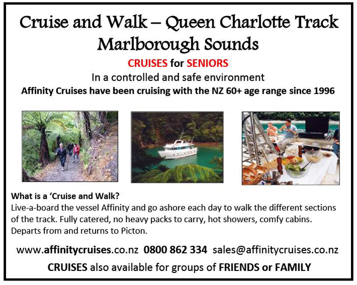
Walk the Queen Charlotte track while staying on Sweet Georgia

Take the comfort and luxury of your own home away with you on your week-long charter holiday to the Queen Charlotte track with Sweet Georgia Cruising.
Let our professional, experienced and highly qualified crew do the work for you! We are fully catered with an onboard chef. With 6 double rooms, we have the space for up to 12 people and have an array of activities for everyone to enjoy including diving, kayaking, paddle boarding, clay bird shooting and we even tow an extra boat behind us for shore transfers or some afternoon fishing.
Contact us today to book your next adventure! Info@sweetgeorgiacruising.com or 027 309 3413
Website: www.sweetgeorgiacruising.com

Peak Hill Walkway

By Canterbury, South Island

Peak Hill walkway has spectacular views

By Yvonne van Eerden

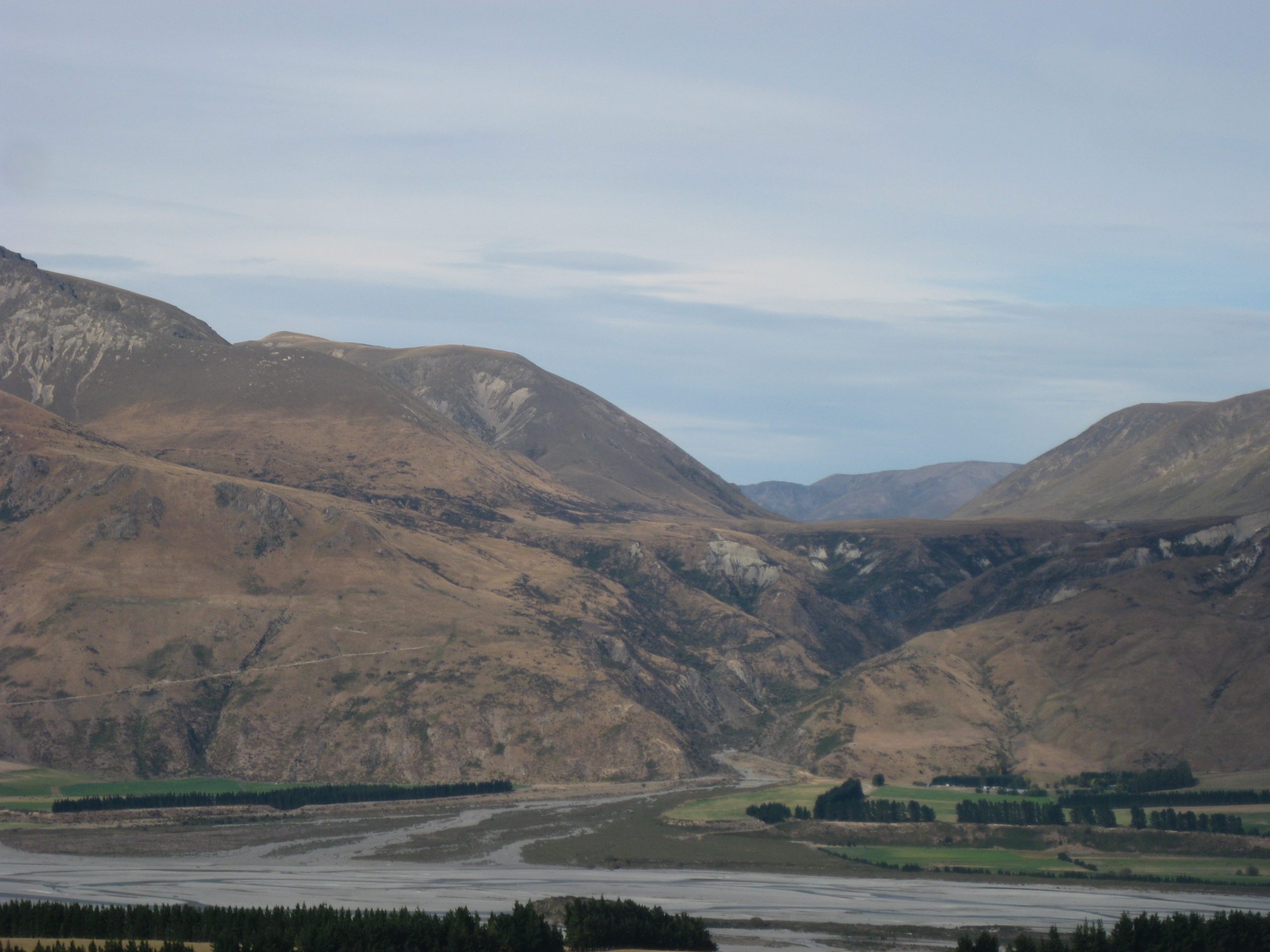
With only had five in our tramping group we headed off from Christchurch at 9.00am to Lake Coleridge where we were going to walk to Peak Hill.

We drove through Lake Coleridge village which is very, very small indeed where there is a power station built in 1914. We checked the power station out on the way home.

We continued on a shingle road for about three kilometres where we could see Peak Hill very clearly.  The weather was very calm, with very little wind.

The views even at the start of the walk were very beautiful.

We organized ourselves and started walking around the paddock by the fence as the farmer does not want anyone to disturb the stock (there was no stock today).  After about 10 minutes we started our climb of Peak Hill.

As we went higher we could see Lake Coleridge, it was very blue and the mountains around were spectacular as well.  You had to stop to catch your breath and to take in the view.  We took lots of photos and took the time to look all around us.

We later stopped for morning tea so that we could all catch up together and then soak in the views once again.  Bill and Denise are very quick at going up and we just plodded along and knew we would eventually get to the top, but I must say several times we thought we were at the top but yet again we had another climb.

Once we were at the top we had our lunch and had views of 360 degrees.  The feeling was wonderful, it was such a great walk and we had made it.

Of course the trip down was very quick but we still took time to look around.  Well worth a day trip out for the family, where you can do as much or as little as you want.

Fact file

From Christchurch the driving distance to the start of the Peak Hill Walkway is about 120km.   Driving time about  one hour 40 minutes.

The walkway is sited adjoining Peak Hill Station,  9kms along Algidus Road in the Lake Coleridge area.

From Algidus Road there is a sign and a marked easement over private land, which will take you to the summit along an unformed route.

The walk should take about three hours return, and is suitable for family groups. Peak Hill is a prominent hill on the shores of Lake Coleridge.

At its peak, 1240m, it offers a stunning overview of the lake and surrounding area on a fine day.

The walk to Peak Hill is extremely exposed to the weather and walkers should be well equipped.

The Greytown Trail

By North Island, Wairarapa Walks

The Greytown Trail in the Wairarapa is a scenic 5km walking and cycling track connecting Greytown’s quieter streets to the nearest train station at Woodside.

There is a small carpark at the end of Cotter Street, South Greytown. The beginning of the trail is marked with an overhead sign and an information board.
The track fenced on both sides, winds between old oak trees on one side, and flaxes on the other. Then a straight bit runs between two mounds or stopbanks, and is edged by trees.
The limestone track is completely flat, but looking east down the track, and you see the dark green bulk of the Tararua Ranges in the distance especially in the afternoon.
Greytown is 60m above sea level while Woodside is 91m, so it is a slightly an uphill walk or cycle to Woodside Station and some people seem to have noticed the difference when going both ways.
According to a local it can be fine at Greytown and raining when you get closer to the hills at Woodside and when you return to Greytown the weather is fine again.
Some of the time the trail runs through or along open paddocks, other times it meanders between rows of magnificent old oak trees. According to the information board, these trees were planted alongside the rails when the railway line was built in 1880, for future use as sleepers, but have never been used due to the line closing in 1953.
The trail runs between farms, some with sheep, others with cattle. Sheep can been seen grazing in the paddocks. There are bench seats along in the shade under the oak trees.
At the 2.5km mark the trail crosses a country road that also happens to be the half way mark. There is an information sign showing the history of the track.
The trail now crosses a stream with a bridge and runs alongside a row of pine trees, before entering open paddocks again.
The end of the trail is near Woodside station where a small section of the original railway track with the old sleepers is displayed by the side of the trail. The rails were made in the UK in 1874.
Woodside Station is a functioning railway station, serving Greytown on the Wairarapa Line. This line between Wellington and Masterton caters for the many commuters who live in the Wairarapa, but work in Wellington.
The old station is still there, on the other side of the railway line. When the new station was built, the old building was used as a storage shed for some years, but was later abandoned.
One the return journey from Woodside back to Greytown one enjoys different views with the Gladstone hills forming a magnificent backdrop and offset with deep green hues from trees that line the pretty colonial streets of Greytown.
History
The original survey for the Wairarapa Line, completed in 1876, considered two routes for the line between Featherston and Masterton: the Central route and the Western route. Despite the protestations of the residents of Greytown, the Western route was chosen due to concerns about the possibility of flooding north of Greytown, which meant that the line bypassed Greytown and passed through Woodside instead.
Woodside opened on 14 May 1880 with the extension of the line from Featherston. Until the line from Woodside to Masterton was completed and opened in November of that year, Woodside was the northern terminus of the Wairarapa Line and was operated by the Public Works Department, initially with two mixed trains between Greytown and Wellington each day.
The amenities at Woodside initially consisted of a station building and stationmaster’s house. The station building was on an island platform between the main line and the Greytown Branch, with the junction at the southern end of the platform. There was road access from north of the platform. The branch (eastern) side had two loops, with capacities of 18 and 11 wagons, while on the main line (western) side there were two loops with capacities of 44 and 35 wagons.
Some years after the closure of the Greytown Branch in 1953 the main line yard was removed, and the station building relocated to a new platform on the western side of the main line. A new crossing loop was installed, and the branch sidings reconfigured.
In 1954 the Greytown station building was relocated to Woodside and modified to serve as a goods shed. It is now disused and the loop and sidings have been removed.
With the opening of the line to Masterton and the reversion of the line to Greytown to branch-line status, Woodside became known as Woodside Junction until the closure of the Greytown Branch in 1953: the platform name board read “Woodside Junction. Change here for Greytown.”
“The trail is the culmination of years of hard work by a dedicated group of Greytown residents, the Greytown Trails Trust,” says Barb Hyde, who is the Marketing Manager for Destination Wairarapa.
The dual purpose track follows the route of the Greytown-Woodside branch rail line, which closed in 1953.  Stage one of the trail was completed in 2011 and stage two in 2013 – with both stages being a total of 5km. The Trust holds regular working bees to ensure the track is maintained and local groups, such as the Ruamahanga Ramblers, often choose it to base their regular running and walking outings.
“Although, a short distance from the Main Street of Greytown – with its boutique shopping and bustling cafes – riders feel like they are in the middle of nowhere. Surrounded by farmland, stunning rural views with the only sound coming from nearby stock, it’s no wonder the trail has grown in popularity for recreational cyclists, walkers and runners over the years,” says Barb.
Plans are afoot to hopefully connect the trail with the nearby township of Featherston and to extend the trail from Woodside so it extends north and loops back to Greytown.
How to get there
From the Greytown end, the 5km trail starts at Cotter Street, the second left off Humphries Road (turn off Main Street at the Challenge Service Station) at the southern end of the town. You can also link up with another cycleway running from Udy Street to the Waiohine River.
The Greytown Trail is suitable for prams, road and mountain bikes. It’s not suitable for racing bikes, horses or motorbikes. And please keep your dog on a leash.
If you’re arriving by train, why not bring your bike and ride into town to work up an appetite for lunch? Or catch a pre-booked Rimutaka Shuttles or Martinborough Shuttles from the station.

Opunake Walkway

By North Island, Taranaki Walks

The Opunake Walkway is the longest of the formal South Taranaki walks and takes you through beautiful lake and beach scenery.

The Opunake Walkway is the longest of the formal South Taranaki walks and takes you through beautiful lake and beach scenery.
It travels around Opunake Lake and across the cliffs, providing views of Te Namu Pa, Mt Taranaki and the rugged coastline. The lake is popular for boating, swimming and water skiing
The walk can be started from a number of easily accessible points but if you wish to complete the whole walk, the best place to begin is by the boat ramp at the Opunake Lake (Layard St).
Along this walk you will find many points of great historic and environmental interest, including:
Opunake Lake The lake is used to provide hydroelectricity. It was once a vegetable garden used to supply the Armed Constabulary and early settlers. There are public toilets at this stop for your use.
Armed Constabulary Cemetery The cemetery is located on the headland that juts into the lake. It has four historic headstones. The perimeters of the cemetery are unknown but some cairns help estimate the cemetery boundaries.
Orimupiko Cemetery This cemetery is adjacent to the entrance to the Armed Constabulary Cemetery. It is located on a former pa site.
Waiaua River Mouth This is a must-stop location – it will offer you extraordinary views of Taranaki’s dynamic coastline.
The Cottage Hospital The hospital was the birthplace of many famous New Zealanders including runner Peter Snell.
Opunake Beach The Riviera of South Taranaki is an outstanding, natural surf attraction that draws visitors and surfers from all over the world. A holiday park and playground are available. The beach was also recently upgraded to offer barbecues and picnic sites for everyone’s use.
The Lion’s Lookout The lookout is located next to the ramp by the old wharf and offers clear views of the Taranaki Bight.
Middleton Bay has a boat ramp for easy launching, though it is not a safe swimming beach.
Te Namu Pa The pa is visible from the northern end of the walkway and is an extremely important site in Taranaki.
It was the location of a famous battle where Wiremu Kingi Matakatea repelled 800 Waikato Maori and successfully withstood a month-long siege armed with a single rifle.
The best access to the site is via Opunake Cemetery and then over the Otahi Stream. Te Namu Pa is on private property and the owners and the Historic Places Trust ask that the area be treated with care and respect. There are open food storage pits and tunnels on the site and these can be dangerous.
There are comprehensive maps for your information at either end of the walk.

Kitchener Park Reserve Walk

By Manawatu Walks, North Island

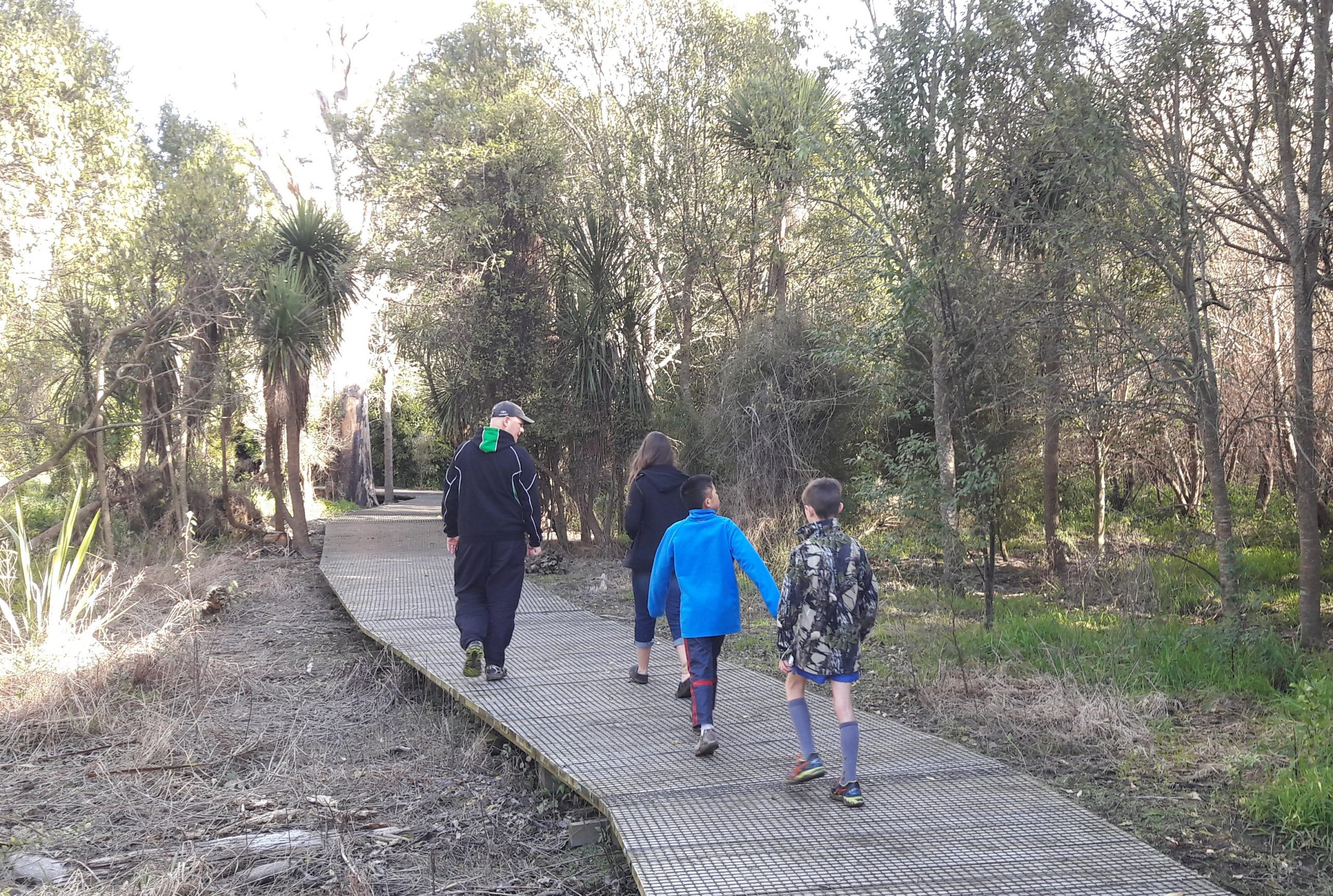
Kitchener Park is a much prized bush reserve, a mere few minutes drive from Feilding, in the Manawatu.

Kitchener Park  was created by the then Feilding Borough Council in 1916 and named after Lord Kitchener, the British Cabinet Minister and War Secretary.

The park is an important remnant of lowland semi-swamp podocarp forest, one of the best and last-remaining in the Manawatu.

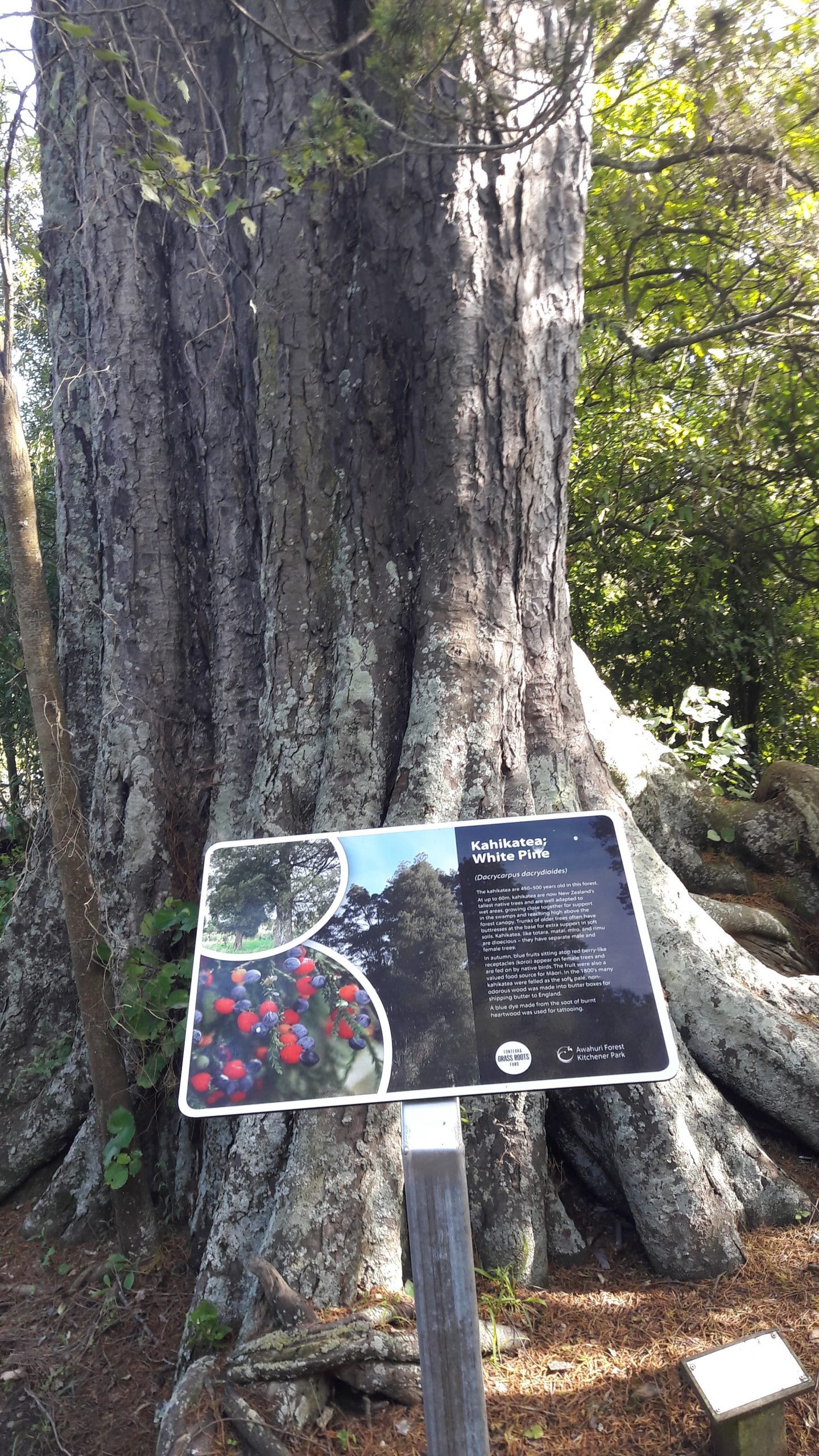
The park contains many fine specimens of kahikatea, totara, rimu, pukatea and kowhai trees, including until recently, New Zealand’s tallest kowhai.   There are also many rare species of fungus and insect life in the park, which have been the subject of some intensive study by national and overseas scientists.

The forest has suffered many flooding events over the years, and sustained major damage in the Feilding floods of 2004, and again in June 2015.

Two significant streams, the Mangaone and the Makino, meet at the park, and flooding has brought major damage to the area, including the introduction of the weed tradescantia (Wandering Jew), which has been an ongoing challenge to control.

When the Feilding Freezing Works closed in 1994, local pastor Gavin Scott gathered a group of unemployed freezing workers, and for many years they maintained the park, constructed boardwalks, and managed the weeds.  Gavin and his many workers,  volunteers, troubled youth, community groups, have put countless hours into improving the park and making it available to visitors.

In 2014, the Manawatu District Council, at the prompting of the then mayor Ian McKelvie, created the Kitchener Park Trust with Geoff Lovegrove, QSM, JP as chairman.  On its inception, the trust appointed Gavin Scott as Honorary Curator.

When the trust sought registration as a trust, it was necessary to change its name, and after consultation with local iwi, Ngati Kauwhata, the official name of the trust became the Awahuri Forest Trust – Kitchener Park.

The weather event of June 2015 severely damaged the boardwalk, and after a year’s delay, the new boardwalk, with extensions, was commenced.   This was completed early in 2017.

The trust has sought funding from various charitable organisations to replace and add new signage and with the support of the Manawatu District Council, has ambitious plans for this significant taonga in the Manawatu, and looks forward to making ongoing improvements to the park.

A large number of people visit the park, where walking and cycling trails are being established, with many opportunities for recreation and study.

Feilding’s Kowhai Park, a major attraction in the town, is also linked to the park with a track that run beside the Makino Stream on one side and Manfield Event Centre on the other, providing an excellent destination for people of all ages to enjoy.

The park has well sign posted directions and signs giving the names of trees and plants.

As a very leisurely pace the walk takes about an hour.  If people wish to stay longer there are a number of clearings ideal for picnics.

Martha Mine Pit Rim Walk

By Bay of Plenty Walks, North Island

By Judy Eva
Waihi’s Pit Rim Walkway/Cycleway is a most enjoyable walk that starts at the Waihi Information Centre and also ends there.

Waihi’s Pit Rim Walkway/Cycleway is a most enjoyable walk that starts at the Waihi Information Centre and also ends there.
Only metres from the centre of Waihi township and directly across the street opposite the I Site (Information Centre) is the start of this great walk/cycle path.
You can take the stairs from the footpath or if you have a bike there is access to the right of the stairs along the footpath where you can use the concrete ramp that is designed for wheelchairs and mobility scooters. This will take you up to the beginning of the walk/cycle path.
This old gothic style Cornish pump house that sits on the top of the hill above the street was based on a design used in the tin mines in Cornwall England. It was used to house the steam engines that operated the huge pumps that kept the Martha Mine from flooding. It looks so grand and gives pleasant memories of the old history of New Zealand. So very great that it has been preserved.
Follow the fenced path to the left and around the top of the rim and as you look down you will be blown away by the size and depth of the pit which was once a hill and is now sitting100ms below sea level.
Unfortunately due to a million tonne fall of rock and earth several years ago access around the complete top area of the rim is closed off for safety reasons and operations of the mine have been put on hold so the original path that circled the top of the mine travels a short distance along the top edge where the rest of the path is netted off and detours onto the street below. This entails travelling a short distance along the street to access the new track.
You will be directed down onto the street by well marked arrow signs which you will follow for the rest of your walk/cycle around the base of the mine. Once on this street turn right and follow the well marked arrow signs where further along you will be directed up a hill on the right. It is from here that the track begins. Unfortunately the rim is now out of view until you return to the finish back at the pump house.
The gravel track continues clockwise around the western end of the mine (well marked by arrows) and meanders through native bush, acres of old gold mining relics are scattered along the way beside the path where it is worth spending some time for a bit of history of old New Zealand.
There are also scenic parklands and a small wetland area along the way. Follow the arrows which will take you back to the start on the top of the rim by the old pump house. There are many delightful café’s in the area of this quaint lovely little town where you can rest your wary legs and body and soak up a well deserved coffee or tea.
Waihi is a town with a history of mining and has adopted the name from the meaning Heart of Gold. It is well worth a visit for those who want to relive the old gold mining days. There is the Waihi Goldmine Discovery Centre that is worth a visit to learn more about this very interesting old town.
The walk is approximately 4 kms and it took me three hours taking into account my casual stopping to explore old relics, taking photos and due to the heat in January I wasn’t in a hurry.

McLaren Falls Park

By Bay of Plenty Walks, North Island

Colourful in Autumn

The best short walk ever? My best short walk has always been around the “Mount” – Mt Maunganui.

By Judy Simpson
But perhaps this walk is even better, 20 kms out of Tauranga, up the Kaimais is McLarens Falls Park.
Leaving the main highway you round a corner and there the rushing, racing waters of the two rivers make a spectacular picture and a great picnic spot but we mustn’t stop as the Park and Autumn calls.
The short drive to the first car park is through an avenue of huge plane trees. They tower above and the brown, yellow leaves cover the tarmac and make a crisping sound under the tyres.
Conveniently, no pun intended, there are excellent toilets, a large story/map board and a small indoor display/information area plus an excellent café, The Falls Retreat. Shut today (Monday)
We like to begin our walk from here as it gives us a longer short walk. Down the steps to the lake, this morning still and reflective. Yea! No wind.
It’s very noisy as the tuis and fantails chat overhead and on the lake the ducks chatter to each other. We wondered what they were saying as they scrabbled across the water.
Lots of swans too but they were silently and elegantly dipping and diving for breakfast.
At every turn we oohed and aahed and the camera clicked and whirred.
We’d missed the best of the colours, the leaves probably ravaged in the last rain storm. Maybe the gingkos are more delicate than the sturdy liquid ambers.
Oh, those liquid amber trees—the leaves so red they looked like raspberries. The path is brilliant. Wide enough for two to walk together and chat and no need to constantly watch your step for tripping roots.
Our short walk follows the edge of the lake closely with bridges and the odd gate to keep the sheep from straying.
The golden bronze of the Swamp Cyprus glowed in the sunshine. It’s strange to see such beautiful trees growing straight up out of the water. Why don’t they get waterlogged and drown?
We stopped to watch a group from a playcentre delightedly toddling around, chasing the ducks and gathering up the bright leaves. Mums, and a Dad too, bravely giving the littlies freedom to run. Phones catching the moment.
What a wonderful sound the swans make as they land on the water and why do the paradise ducks always stay on the other side of the lake? A congregation of noise.
Further on the liquid ambers drape into the water and the flax bushes make a hiding place for the little black coots. Across the lake the paddocks turn into a forest of pine trees. Their reflections looking like a spill of huge matchsticks.
The track narrows and the walk slips through a wetland where the pukekos fluff their white bottom feathers at you and dive into a hidey hole in the swamp.
The path leads into stand of native bush. It’s damp and mossy and much cooler in here. Steps up give you a good cardiac workout. (you can avoid these by taking a short cut up through the freedom camping ground).
Along the road a little way and over a cattlestop and then it’s “choices.” Climb up more steps on the right for a longer walk, views and a chat with the sheep or amble along the road for a short distance and rejoin the lakeside track.
Funny how everything looks different on the homeward journey. You always seem to see something you missed.
On a weekday morning, with few people about this is a magic walk at any time of the year. The coffee shop open would be icing on the cake.
A short walk to share.
McLarens Falls Park is managed by the Tauranga City Council. It is 20 kms from Tauranga on SH 29.