Category

North Island

The Greytown Trail

By North Island, Wairarapa Walks

The Greytown Trail in the Wairarapa is a scenic 5km walking and cycling track connecting Greytown’s quieter streets to the nearest train station at Woodside.

There is a small carpark at the end of Cotter Street, South Greytown. The beginning of the trail is marked with an overhead sign and an information board.
The track fenced on both sides, winds between old oak trees on one side, and flaxes on the other. Then a straight bit runs between two mounds or stopbanks, and is edged by trees.
The limestone track is completely flat, but looking east down the track, and you see the dark green bulk of the Tararua Ranges in the distance especially in the afternoon.
Greytown is 60m above sea level while Woodside is 91m, so it is a slightly an uphill walk or cycle to Woodside Station and some people seem to have noticed the difference when going both ways.
According to a local it can be fine at Greytown and raining when you get closer to the hills at Woodside and when you return to Greytown the weather is fine again.
Some of the time the trail runs through or along open paddocks, other times it meanders between rows of magnificent old oak trees. According to the information board, these trees were planted alongside the rails when the railway line was built in 1880, for future use as sleepers, but have never been used due to the line closing in 1953.
The trail runs between farms, some with sheep, others with cattle. Sheep can been seen grazing in the paddocks. There are bench seats along in the shade under the oak trees.
At the 2.5km mark the trail crosses a country road that also happens to be the half way mark. There is an information sign showing the history of the track.
The trail now crosses a stream with a bridge and runs alongside a row of pine trees, before entering open paddocks again.
The end of the trail is near Woodside station where a small section of the original railway track with the old sleepers is displayed by the side of the trail. The rails were made in the UK in 1874.
Woodside Station is a functioning railway station, serving Greytown on the Wairarapa Line. This line between Wellington and Masterton caters for the many commuters who live in the Wairarapa, but work in Wellington.
The old station is still there, on the other side of the railway line. When the new station was built, the old building was used as a storage shed for some years, but was later abandoned.
One the return journey from Woodside back to Greytown one enjoys different views with the Gladstone hills forming a magnificent backdrop and offset with deep green hues from trees that line the pretty colonial streets of Greytown.
History
The original survey for the Wairarapa Line, completed in 1876, considered two routes for the line between Featherston and Masterton: the Central route and the Western route. Despite the protestations of the residents of Greytown, the Western route was chosen due to concerns about the possibility of flooding north of Greytown, which meant that the line bypassed Greytown and passed through Woodside instead.
Woodside opened on 14 May 1880 with the extension of the line from Featherston. Until the line from Woodside to Masterton was completed and opened in November of that year, Woodside was the northern terminus of the Wairarapa Line and was operated by the Public Works Department, initially with two mixed trains between Greytown and Wellington each day.
The amenities at Woodside initially consisted of a station building and stationmaster’s house. The station building was on an island platform between the main line and the Greytown Branch, with the junction at the southern end of the platform. There was road access from north of the platform. The branch (eastern) side had two loops, with capacities of 18 and 11 wagons, while on the main line (western) side there were two loops with capacities of 44 and 35 wagons.
Some years after the closure of the Greytown Branch in 1953 the main line yard was removed, and the station building relocated to a new platform on the western side of the main line. A new crossing loop was installed, and the branch sidings reconfigured.
In 1954 the Greytown station building was relocated to Woodside and modified to serve as a goods shed. It is now disused and the loop and sidings have been removed.
With the opening of the line to Masterton and the reversion of the line to Greytown to branch-line status, Woodside became known as Woodside Junction until the closure of the Greytown Branch in 1953: the platform name board read “Woodside Junction. Change here for Greytown.”
“The trail is the culmination of years of hard work by a dedicated group of Greytown residents, the Greytown Trails Trust,” says Barb Hyde, who is the Marketing Manager for Destination Wairarapa.
The dual purpose track follows the route of the Greytown-Woodside branch rail line, which closed in 1953.  Stage one of the trail was completed in 2011 and stage two in 2013 – with both stages being a total of 5km. The Trust holds regular working bees to ensure the track is maintained and local groups, such as the Ruamahanga Ramblers, often choose it to base their regular running and walking outings.
“Although, a short distance from the Main Street of Greytown – with its boutique shopping and bustling cafes – riders feel like they are in the middle of nowhere. Surrounded by farmland, stunning rural views with the only sound coming from nearby stock, it’s no wonder the trail has grown in popularity for recreational cyclists, walkers and runners over the years,” says Barb.
Plans are afoot to hopefully connect the trail with the nearby township of Featherston and to extend the trail from Woodside so it extends north and loops back to Greytown.
How to get there
From the Greytown end, the 5km trail starts at Cotter Street, the second left off Humphries Road (turn off Main Street at the Challenge Service Station) at the southern end of the town. You can also link up with another cycleway running from Udy Street to the Waiohine River.
The Greytown Trail is suitable for prams, road and mountain bikes. It’s not suitable for racing bikes, horses or motorbikes. And please keep your dog on a leash.
If you’re arriving by train, why not bring your bike and ride into town to work up an appetite for lunch? Or catch a pre-booked Rimutaka Shuttles or Martinborough Shuttles from the station.

Opunake Walkway

By North Island, Taranaki Walks

The Opunake Walkway is the longest of the formal South Taranaki walks and takes you through beautiful lake and beach scenery.

The Opunake Walkway is the longest of the formal South Taranaki walks and takes you through beautiful lake and beach scenery.
It travels around Opunake Lake and across the cliffs, providing views of Te Namu Pa, Mt Taranaki and the rugged coastline. The lake is popular for boating, swimming and water skiing
The walk can be started from a number of easily accessible points but if you wish to complete the whole walk, the best place to begin is by the boat ramp at the Opunake Lake (Layard St).
Along this walk you will find many points of great historic and environmental interest, including:
Opunake Lake The lake is used to provide hydroelectricity. It was once a vegetable garden used to supply the Armed Constabulary and early settlers. There are public toilets at this stop for your use.
Armed Constabulary Cemetery The cemetery is located on the headland that juts into the lake. It has four historic headstones. The perimeters of the cemetery are unknown but some cairns help estimate the cemetery boundaries.
Orimupiko Cemetery This cemetery is adjacent to the entrance to the Armed Constabulary Cemetery. It is located on a former pa site.
Waiaua River Mouth This is a must-stop location – it will offer you extraordinary views of Taranaki’s dynamic coastline.
The Cottage Hospital The hospital was the birthplace of many famous New Zealanders including runner Peter Snell.
Opunake Beach The Riviera of South Taranaki is an outstanding, natural surf attraction that draws visitors and surfers from all over the world. A holiday park and playground are available. The beach was also recently upgraded to offer barbecues and picnic sites for everyone’s use.
The Lion’s Lookout The lookout is located next to the ramp by the old wharf and offers clear views of the Taranaki Bight.
Middleton Bay has a boat ramp for easy launching, though it is not a safe swimming beach.
Te Namu Pa The pa is visible from the northern end of the walkway and is an extremely important site in Taranaki.
It was the location of a famous battle where Wiremu Kingi Matakatea repelled 800 Waikato Maori and successfully withstood a month-long siege armed with a single rifle.
The best access to the site is via Opunake Cemetery and then over the Otahi Stream. Te Namu Pa is on private property and the owners and the Historic Places Trust ask that the area be treated with care and respect. There are open food storage pits and tunnels on the site and these can be dangerous.
There are comprehensive maps for your information at either end of the walk.

Kitchener Park Reserve Walk

By Manawatu Walks, North Island

Kitchener Park is a much prized bush reserve, a mere few minutes drive from Feilding, in the Manawatu.

Kitchener Park  was created by the then Feilding Borough Council in 1916 and named after Lord Kitchener, the British Cabinet Minister and War Secretary.

The park is an important remnant of lowland semi-swamp podocarp forest, one of the best and last-remaining in the Manawatu.

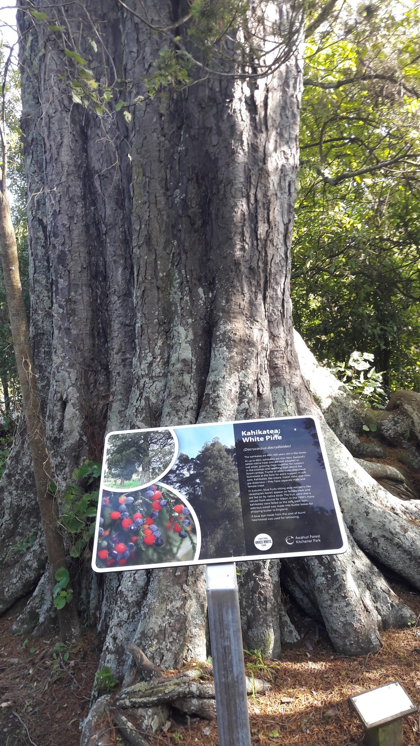
The park contains many fine specimens of kahikatea, totara, rimu, pukatea and kowhai trees, including until recently, New Zealand’s tallest kowhai.   There are also many rare species of fungus and insect life in the park, which have been the subject of some intensive study by national and overseas scientists.

The forest has suffered many flooding events over the years, and sustained major damage in the Feilding floods of 2004, and again in June 2015.

Two significant streams, the Mangaone and the Makino, meet at the park, and flooding has brought major damage to the area, including the introduction of the weed tradescantia (Wandering Jew), which has been an ongoing challenge to control.

When the Feilding Freezing Works closed in 1994, local pastor Gavin Scott gathered a group of unemployed freezing workers, and for many years they maintained the park, constructed boardwalks, and managed the weeds.  Gavin and his many workers,  volunteers, troubled youth, community groups, have put countless hours into improving the park and making it available to visitors.

In 2014, the Manawatu District Council, at the prompting of the then mayor Ian McKelvie, created the Kitchener Park Trust with Geoff Lovegrove, QSM, JP as chairman.  On its inception, the trust appointed Gavin Scott as Honorary Curator.

When the trust sought registration as a trust, it was necessary to change its name, and after consultation with local iwi, Ngati Kauwhata, the official name of the trust became the Awahuri Forest Trust – Kitchener Park.

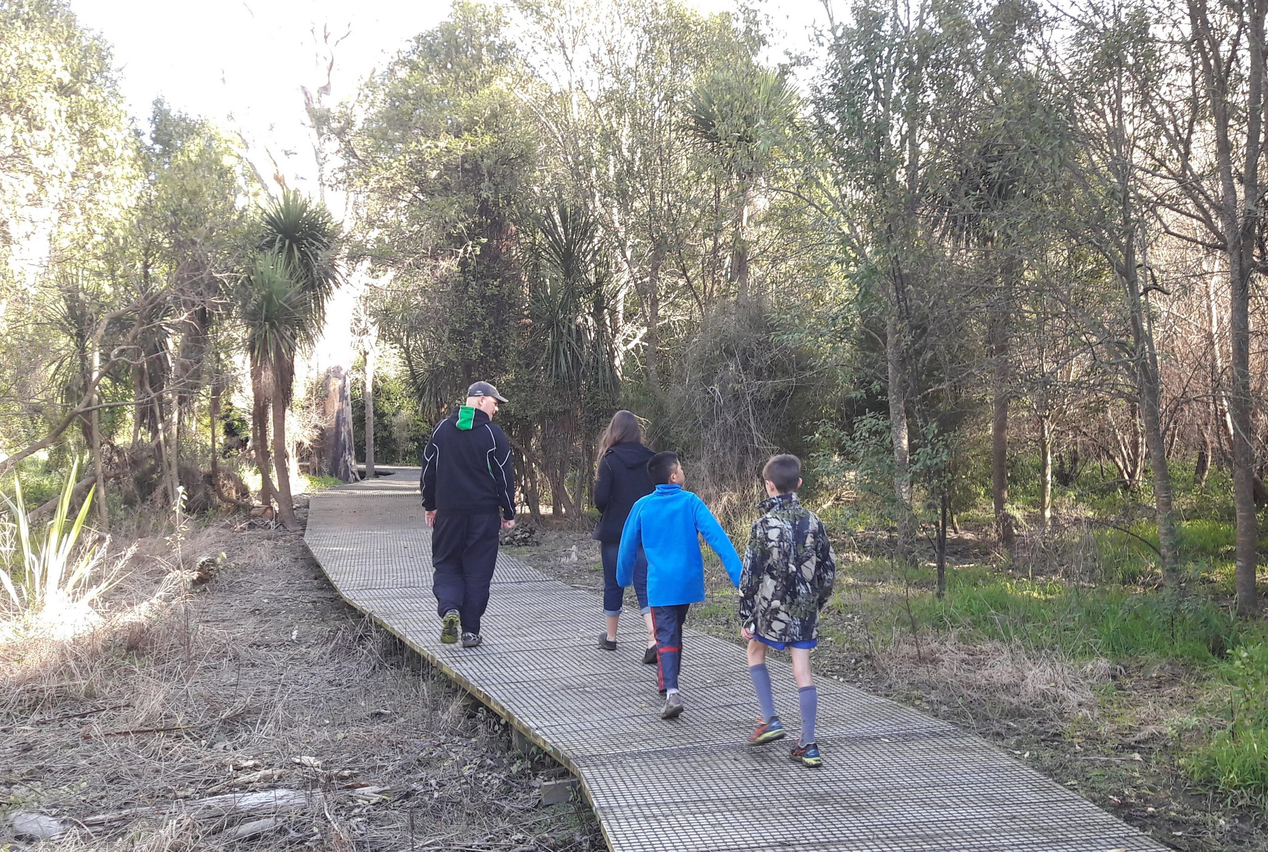
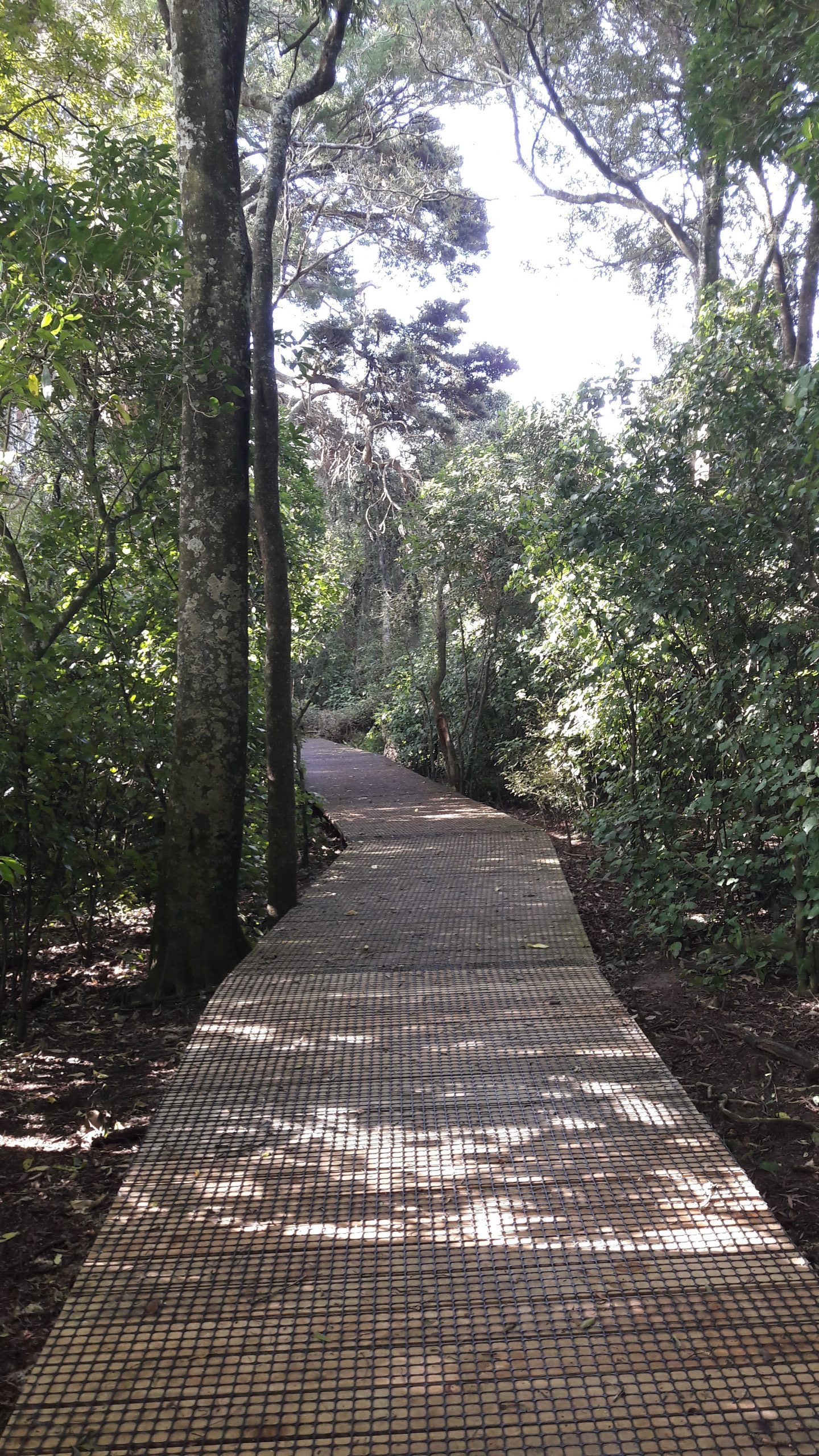
The weather event of June 2015 severely damaged the boardwalk, and after a year’s delay, the new boardwalk, with extensions, was commenced.   This was completed early in 2017.

The trust has sought funding from various charitable organisations to replace and add new signage and with the support of the Manawatu District Council, has ambitious plans for this significant taonga in the Manawatu, and looks forward to making ongoing improvements to the park.

A large number of people visit the park, where walking and cycling trails are being established, with many opportunities for recreation and study.

Feilding’s Kowhai Park, a major attraction in the town, is also linked to the park with a track that run beside the Makino Stream on one side and Manfield Event Centre on the other, providing an excellent destination for people of all ages to enjoy.

The park has well sign posted directions and signs giving the names of trees and plants.

As a very leisurely pace the walk takes about an hour.  If people wish to stay longer there are a number of clearings ideal for picnics.

Martha Mine Pit Rim Walk

By Bay of Plenty Walks, North Island

By Judy Eva
Waihi’s Pit Rim Walkway/Cycleway is a most enjoyable walk that starts at the Waihi Information Centre and also ends there.

Waihi’s Pit Rim Walkway/Cycleway is a most enjoyable walk that starts at the Waihi Information Centre and also ends there.
Only metres from the centre of Waihi township and directly across the street opposite the I Site (Information Centre) is the start of this great walk/cycle path.
You can take the stairs from the footpath or if you have a bike there is access to the right of the stairs along the footpath where you can use the concrete ramp that is designed for wheelchairs and mobility scooters. This will take you up to the beginning of the walk/cycle path.
This old gothic style Cornish pump house that sits on the top of the hill above the street was based on a design used in the tin mines in Cornwall England. It was used to house the steam engines that operated the huge pumps that kept the Martha Mine from flooding. It looks so grand and gives pleasant memories of the old history of New Zealand. So very great that it has been preserved.
Follow the fenced path to the left and around the top of the rim and as you look down you will be blown away by the size and depth of the pit which was once a hill and is now sitting100ms below sea level.
Unfortunately due to a million tonne fall of rock and earth several years ago access around the complete top area of the rim is closed off for safety reasons and operations of the mine have been put on hold so the original path that circled the top of the mine travels a short distance along the top edge where the rest of the path is netted off and detours onto the street below. This entails travelling a short distance along the street to access the new track.
You will be directed down onto the street by well marked arrow signs which you will follow for the rest of your walk/cycle around the base of the mine. Once on this street turn right and follow the well marked arrow signs where further along you will be directed up a hill on the right. It is from here that the track begins. Unfortunately the rim is now out of view until you return to the finish back at the pump house.
The gravel track continues clockwise around the western end of the mine (well marked by arrows) and meanders through native bush, acres of old gold mining relics are scattered along the way beside the path where it is worth spending some time for a bit of history of old New Zealand.
There are also scenic parklands and a small wetland area along the way. Follow the arrows which will take you back to the start on the top of the rim by the old pump house. There are many delightful café’s in the area of this quaint lovely little town where you can rest your wary legs and body and soak up a well deserved coffee or tea.
Waihi is a town with a history of mining and has adopted the name from the meaning Heart of Gold. It is well worth a visit for those who want to relive the old gold mining days. There is the Waihi Goldmine Discovery Centre that is worth a visit to learn more about this very interesting old town.
The walk is approximately 4 kms and it took me three hours taking into account my casual stopping to explore old relics, taking photos and due to the heat in January I wasn’t in a hurry.

McLaren Falls Park

By Bay of Plenty Walks, North Island

Colourful in Autumn

The best short walk ever? My best short walk has always been around the “Mount” – Mt Maunganui.

By Judy Simpson
But perhaps this walk is even better, 20 kms out of Tauranga, up the Kaimais is McLarens Falls Park.
Leaving the main highway you round a corner and there the rushing, racing waters of the two rivers make a spectacular picture and a great picnic spot but we mustn’t stop as the Park and Autumn calls.
The short drive to the first car park is through an avenue of huge plane trees. They tower above and the brown, yellow leaves cover the tarmac and make a crisping sound under the tyres.
Conveniently, no pun intended, there are excellent toilets, a large story/map board and a small indoor display/information area plus an excellent café, The Falls Retreat. Shut today (Monday)
We like to begin our walk from here as it gives us a longer short walk. Down the steps to the lake, this morning still and reflective. Yea! No wind.
It’s very noisy as the tuis and fantails chat overhead and on the lake the ducks chatter to each other. We wondered what they were saying as they scrabbled across the water.
Lots of swans too but they were silently and elegantly dipping and diving for breakfast.
At every turn we oohed and aahed and the camera clicked and whirred.
We’d missed the best of the colours, the leaves probably ravaged in the last rain storm. Maybe the gingkos are more delicate than the sturdy liquid ambers.
Oh, those liquid amber trees—the leaves so red they looked like raspberries. The path is brilliant. Wide enough for two to walk together and chat and no need to constantly watch your step for tripping roots.
Our short walk follows the edge of the lake closely with bridges and the odd gate to keep the sheep from straying.
The golden bronze of the Swamp Cyprus glowed in the sunshine. It’s strange to see such beautiful trees growing straight up out of the water. Why don’t they get waterlogged and drown?
We stopped to watch a group from a playcentre delightedly toddling around, chasing the ducks and gathering up the bright leaves. Mums, and a Dad too, bravely giving the littlies freedom to run. Phones catching the moment.
What a wonderful sound the swans make as they land on the water and why do the paradise ducks always stay on the other side of the lake? A congregation of noise.
Further on the liquid ambers drape into the water and the flax bushes make a hiding place for the little black coots. Across the lake the paddocks turn into a forest of pine trees. Their reflections looking like a spill of huge matchsticks.
The track narrows and the walk slips through a wetland where the pukekos fluff their white bottom feathers at you and dive into a hidey hole in the swamp.
The path leads into stand of native bush. It’s damp and mossy and much cooler in here. Steps up give you a good cardiac workout. (you can avoid these by taking a short cut up through the freedom camping ground).
Along the road a little way and over a cattlestop and then it’s “choices.” Climb up more steps on the right for a longer walk, views and a chat with the sheep or amble along the road for a short distance and rejoin the lakeside track.
Funny how everything looks different on the homeward journey. You always seem to see something you missed.
On a weekday morning, with few people about this is a magic walk at any time of the year. The coffee shop open would be icing on the cake.
A short walk to share.
McLarens Falls Park is managed by the Tauranga City Council. It is 20 kms from Tauranga on SH 29.

Pukerua Bay to Plimmerton

By North Island, Wellington Walks

Wednesday Trampers go to the Seaside

Words by Ian Brookes, Photos by William

In November, 18 intrepid Wednesday trampers and a small dog left Memorial Park at 7.30am for their annual trip to the beach at Pukerua Bay north of Wellington.

On our way south, the weather looked rather threatening, with low cloud over the Tararua Ranges (using the terminology recommended in Backcountry), but clearer out to sea. We assembled at the end of the Pukerua Bay Beach Road to walk round the Wairaka Headland to Plimmerton and return via the inland route.

There was a chilly breeze from the West as we set off, but this dropped once we rounded Wairaka Head and the weather from thereon was fine and sunny.

The path is flanked by steep grassy slopes on which a number of feral goats were seen grazing. We soon reached a strategically placed wooden gate leaning against the rocks which is easily climbed and then after a scramble round the  headland made it on to a long sweep of beach. This consists of large pebbles and small boulders, which need care in negotiating.

On the way, we encountered a small dead blue penguin washed up on the beach. There is plenty of driftwood at the high tide mark, and after an hour’s walking we chose to sit on some largish logs for morning tea.

The beach eventually leads to a further half hour’s walking on a gravel track heading towards Plimmerton. While on the track, we encountered a walker with two large dogs. An attempt to get them onto leads was only partially successful and one of them charged towards one of our trampers, but no damage was done.
Having passed through the Hongoeka Marae Village, we reached the boating club, where four of our number decided to head into Plimmerton and take the train back to Pukerua Bay.

The rest of us continued into the Karehana Bay Scenic Reserve, where we had lunch at the bottom of a long and steep flight of steps. These provided a challenge immediately after lunch, but the party all reached the top, albeit somewhat puffed.

We then headed up the Taua Tapu Track passing alpacas and donkeys on lifestyle blocks. The track reaches a trig at 114 metres and then descends to Airlie Road. We followed this past the Whenua Tapu Crematorium until we reached the Ara Harakeke walkway which runs parallel to SH1. This winds uphill for about two kilometres to the Pukerua Bay shops. Walking on the asphalt left some trampers in need of refreshment and it was disappointing to find the dairy’s ice cream chiller had lost power.

Another 20 minutes along Rawhiti Road led to the Goat Track, which descends by a number of steep steps down to the beach. Everyone was back to the vehicles by 2.15pm to find the train travellers had arrived safely before us. We then reconvened for coffee and ice creams in Paekakariki.

It was generally agreed that this was the preferred route, rather than that in previous years, when we went inland first. Doing it this way meant the rocky beach was tackled at the start of the day, even though the finish involved the rather tedious walk up the shared cycle path. The statistics collected at the end of the day showed we had walked a distance of almost 17 kilometers.

Te Henui Extension

By North Island, Taranaki Walks

Te Henui extension  a rustic and interesting stroll

Popular New Plymouth walk by Judy Eva

The popular award winning Te Henui Walk/Cycleway which starts at East End Beach, New Plymouth and follows the Te Henui River exiting in  Cumberland Street, has an extension probably not well known to visitors.

It carries on across Cumberland Street and through a rustic and interesting stroll.

If you have started the walk from the east end and exited at Cumberland Street turn right onto the footpath, over the road bridge and cross Cumberland Street to the grass area where there is a New Plymouth District Council signpost just off the footpath titled Te Henui Extension and Durham Avenue each with an arrow pointing to the start of the walk. These are the arrows you need to follow. The track starts at the rear of the grassy area.

The extension walk is very different to the main Te Henui Walk/Cycleway (not suitable for bikes) and is broken into different area’s which involves walking through several streets and can be quite confusing, however is worth making the effort.

The track is more narrow but well maintained. It starts off with a pleasant rustic walk, the river on your left side and a view down into a valley that has a grotto of punga trees and ferns. There are several little wooden bridges along the way.

There are several signposts on the right side of the track that take you up to the road above, leads to several streets and is the main road to Inglewood. Not for you.

Keep following the main track (river on your left) until you come to about 12 steps with a forked path at the top leading left and right. Keep left and follow the signpost that says Durham Avenue continuing around through an open space where you will come to a bush area with steps leading down into a tree covered dell and over a small wooden bridge before climbing up stairs to the top again.

When you reach the top veer right and take the short narrow path that leads between fenced houses on either side ending out onto the top end of Durham Avenue which is a cul de sac.

Cross over onto the left side of the street and walk down to the bottom where you will be in Junction Street. Turn left and then left again at the next corner which is London Terrace. A short way along there is a lane on the right hand side of the road leading up a hill with a sign at the entrance stating Access to Heta Road.

Walk up the lane turning right at the top (there are houses on either side) and follow the lane to the end where there is a walkway exit on the right that takes you onto Heta Road. At this point if you do not wish to continue the walk, turn left on Heta Road walk to the bottom of the hill and you will be back in Cumberland Street. If you wish to continue the walk cross Heta Road turn right and then left into a small cul de sac further along called Frank Frethey Place.

Cross over onto the right hand side of Frank Frethey Place, walk a short distance along and you will see a grass lane entrance between number 10 and number 12. Take this entrance where there are steps leading down to another tree and bush covered dell.

Another lot of steep steps to climb up again and the track will then take you out into an open space where there is a fork, one leading into a street and housing area and the other turning left down a hill. Take the left and you will be walking on a gravel path alongside a large timber and corrugated iron fence on your right and a ditch on your left.

As you walk further on there will be houses on either side and the ditch will now be on your right. This area is new housing.

This path will eventually lead you through another short tree lined track and out onto the bottom of Heta Road where the walk finishes.

Turn the right and a short distance takes you back onto Cumberland Street, turn left there, cross the road and you will be back at the entrance to the main Te Henui Walkway that leads back to East End Beach. If the road is busy with traffic there is an underpass you can use.

If you don’t wish to do the complete walk starting at East End you can start the extension walk from Cumberland Street where you can park your car if you have one. The entrance to both walkways is at the bottom of the hill in Cumberland Street. Plenty of parking there.

The extension walk is easy walking and the steep stairs up and down in both dells are the only challenging part. You need good walking shoes. This walk would be about an hour to an hour and a half from the Cumberland Street entrance.

Shine Falls walks

By Hawke's Bay Walks, North Island

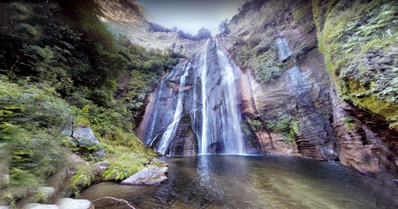
Rising 58 metres, Shine Falls is Hawke’s Bay’s most spectacular waterfall.

Shine Falls is roughly a 1.5 hours drive away from Napier, and the last 12km is gravel road – but it’s worth the trip!
The Shine Falls track is a 1.5 hour return walk, and leads to the base of the waterfall. The walk passes through farmland and beneath towering sandstone bluffs. There are some uphill sections on the track as well as stream crossings, but they are all bridged and easy. Low-land forest includes kanuka, kawakawa, kowhai and titoki.

Getting there
From Napier, head north-east on SH2 and follow it for the next 43.5km until you see the ‘Shine Falls’ sign, where you need to turn left into Matahorua Rd. After 11km turn left into Heays Access Rd. Follow this road for 6.5 km until you reach a DOC car park, on your left, with a picnic table (no toilets).

Kamahi Loop Track to Shine Falls and Heays Accesss Road

The Kamahi Loop Track is another but longer walk taking in Shine Falls in Hawkes Bay.
The walk time is five hours one way over a distance of 8.3km.
Starting at the Pohokura Road car park and taking in part of the Tūmanako and Kamahi loops, visitors experience a cross-section of the reserve’s features – including an ancient mataī about 800 years old and birds such as tītitipounamu/rifleman and the reintroduced pītoitoi/North Island robin.
Middle Track, between the midpoint of Kamahi Loop and Shine Falls, may be steep and rough in some sections.
From above Shine Falls, the track descends steeply through stands of rewarewa, crossing Boundary Stream to reach the bottom of the spectacular Shine Falls before continuing to Heays Access Road.

Getting there
Boundary Stream Mainland Island is located approximately one hour’s drive north of Napier.
Follow State Highway 2 to Tutira, turn left at Tutira onto Matahorua Road then left onto Pohokura Road.

Tarawera – a legacy to uphold

By North Island, Rotorua Walks

Lake Tarawera area for great nature walks

Lake Tarawera including Lake Rotomahana was were tourism in New Zealand started.

People came from all over the world to visit what was known as the Eighth Wonder of the World, The Pink and White Terraces. They not only came for the beauty the Terraces beheld, but in those days, many were looking for relief or hopefully a cure from their ailments by bathing in the pools of the Terraces.
Well, that all changed on the 10th of June 1886 with the eruption of Mt Tarawera, an event that lasted only five hours. I n doing so it split the mountain open its entire length, continued through the hydrothermal of Lake Rotomahana with a fissure of more than 17km.
What nature had created over a 1000 years; it had also decimated in the blink of an eye. The Terraces were gone. The eruption was the largest natural disaster to have occurred in the commonwealth up until that time.
Forward 134 years to the present day and Lake Tarawera and the surrounding area has once again become one of the most stunning places of natural beauty in New Zealand.
Large clusters of pohutukawa, mamaku and rewarewa surround the lake, right down to its waters edge with housing taking in only a small portion on one side of the lake.
The backdrop to Lake Tarawera is still dominated by the awesome presence of Mount Tarawera itself. More correctly Tarawera is made up of three mountains, from the left, Wahanga (the sacred mountain), Ruawahia in the centre and Tarawera being the right-hand side. Up until around 20 years ago people freely walked Tarawera, but this was halted by the Ngati Rangitihi mountain top owners.
In 2013 the Tarawera Trail was opened. This was a first in New Zealand as a joint project between DOC and six Maori block owners which the trail now crosses. The trail itself is 15km long starting at the Te Waiora – Tarawera Trail car park 400m south of the Buried Village.
It takes an average of four to five hours to walk to Hot Water Beach for moderate walkers which is the end point of the trail. There are many highlights along the mostly bush covered walk that make it pretty special, finishing with a soak in the thermal waters at Hot Water Beach after your walk.
There are many beautiful viewing spots of Mt Tarawera and a couple of great beaches for lake swimming or a lunch-stop along the way.
There is the option to camp at the Hot Water Beach DOC campsite at the end of your walk or take the water taxi back including the free shuttle back to your car.  If you decide to camp you can get the water taxi to deliver your gear to save you having to carrying it in. You do need to pre-book your campsite on www.whakarewarewa.com. If you would like a glamourous camping option for a couple of nights you could book to stay at the Totally Tarawera glamping site which could include your dinner and breakfast hamper.  View this on www.totallytarawera.com.
One of the lesser known walks at Lake Tarawera, although rated by DOC as one of the best short walks in New Zealand, is the Tarawera Falls walk.  Accessed via Kawereu, after obtaining a permit from the local Kawereu I-site, it allows you to drive the forest road to within 15 minutes of the falls themselves or you can organise a water taxi to drop you off at the Outlet (Te Tapahoro) for the one and a half hour walk to the falls. The falls are spectacular, but the walk to and from the lake is equally stunning as you follow the river down from Lake Tarawera. There are three additional waterfalls along the walk, and if you look carefully you will see where the water disappears underground prior to it emerging through a hole in the cliff, that makes up the Tarawera Falls themselves.
There are several other combination walks around Lake Tarawera, one being via Lake Okataina to Humpheries Bay and on to the Outlet, a walk of around five hours. From there you can stay at Te Tapahoro DOC campsite for the night or catch the water taxi out to the Landing.  Added to that could be a walk from Lake Okeraka along the Western Okataina, then eastern Okataina walkway ending up at the Outlet a walk best taken over two days. Camping is an option at Humpheries Bay and at the Outlet.
Totally Tarawera is a family business at Lake Tarawera that links back to the Maori tribal guides who hosted and took care of international visitors across Lake Tarawera to The Pink and White Terraces. This family legacy continues on the lake today where they provide water taxi service, guided cultural tours, glamping and lake cruises.
Karen says It is about manaaki, caring for our visitors and ensuring they have a memorable experiences with us.  A legacy that has with stood over 150 years.

Spoilt for choice in Wellington

By North Island, Wellington Walks

Lots of amazing walks in our Capital city

By Judith Doyle

For a capital city with an ever-increasing population, Wellington has an amazing choice of walks, even close to the city. From my home in the city suburb of Oriental Bay, I can decide on a waterfront wander, east or west; a bush and hillside walk; a climb to the top of Mt Victoria or a stroll along suburban roads with flashes of water between the houses.

Downhill at the seafront I have two choices. Go east and watch the dogs on the beach in winter, the swimmers and sunbathers in high summer and all the variations of weather and people at other times.

The road follows the curve of the beach until it reaches Point Jerningham where I can round the point and walk on to the cosy little curve of Balaena Bay. Here I often see windsurfers skipping across Evans Bay like syncopated butterflies.

If I choose to turn west at the seafront, I pass the whale statue (pictured) which was donated to the city by its sculptor Colin Webster-Watson.

Further on, I watch the children playing on the jungle-gym where a small boy always seems to be climbing up the slide and colliding with a child sliding down.

Past the Tugboat café moored in its own the little lagoon, I like to drop down from the footpath and walk along the edge of the water past the blue-fronted boatsheds, enjoying the variety of craft in the lagoon and occasionally peering into any boatshed that’s open to see the conglomeration of sailing equipment inside.

Up and past Clyde Quay with its classy restaurant and apartments, I walk towards the city past the statue (pictured) of a naked man by English sculptor Max Patte. Called Solace in the Wind, it leans out towards the harbour and is a favorite spot for tourist photos. It was donated to the city 11 years ago by its Patte, originally as a parting gift to a city he had worked in and enjoyed. But  later he found he’d enjoyed it so much that, in fact, he decided to stay.

If I decide to turn uphill from my home instead of downhill, then the whole Town Belt is at my disposal. I walk up a zigzag pathway that leads to the Monastery where I can turn left and later right to reach Charles Plimmer Park and then the variety of tracks in the Town Belt. Here are bushy tracks that even the sharpest Wellington winds cannot penetrate.

If I take one direction, I look down over Oriental Bay or up into the bush with its half-hidden houses. I then have a choice of tracks leading back down to the beach. Other tracks can be taken to the top of Mt Victoria (my energy doesn’t stretch to that walk very often these days) or along towards Newtown where I can walk through bush. Occasionally gaps in the bush allow me to gaze across towards the Basin Reserve.

For the growing numbers living in apartments, which will increase in future years according to current estimates, these walks and many others near the city are of enormous value.

We are so lucky that, in early days, a Town Belt of trees was reserved to encircle the city. Although a few ‘bites’ were taken out of it occasionally in the past, it is now protected legally and is sancrosant. The Town Belt and the tracks within it are a precious heritage and must be diligently protected forever.